The first couple of days out of Nuka Hiva we enjoyed some of the smoothest sailing we've had to date. So much so that we instigated a film night - with the laptop playing DVDs at the top of the companionway while we watched from the cockpit - the sea was calm enough to remove the worry of breaking waves or sudden rolls harming the computer. However by the second night we'd entered a area of squally, showery weather with Kika alternately over-pressed, or crashing around in the calm which followed the squall. It made for a hard, wet night of reefing, unreefing and hand-steering. One compensation is that there's a full moon at present, so at least we can see what we're doing.
After the squally night the weather moderated, with the squalls becoming less severe and the "calms" bringing sufficient wind to keep the sails full. Last night we were less concerned with the variable wind than with passing safely past the "Iles du Desappointment" - the Admiralty chart and electronic charts disagreed by 5nmiles so we picked the most pessimistic and added another 5nmiles. The wind had other ideas and we were kept busy tweaking the self-steering and sails so that by dawn we'd changed from sailing a fine reach through to a dead run to ensure we didn't make an early unexpected landfall.
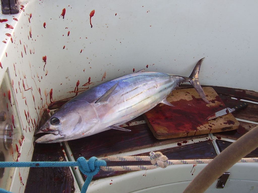
We've been craving fresh-fish and clearly still haven't fully grasped all the skills required, as we'd been unsuccessful so far. This morning I set the line, more out of routine than expectation, but 30 minutes later the scream of the winch as the fish took the line, alerted us to our first bite of since we left the Marquesas. After some effort we landed a fat 75cm tuna and the fridge has once again something to do.
We hope to make landfall at first light. The pilot guide says, "these islands have with truth been called the low or dangerous archipelago. This derives from their low-lying character, only becoming visible from the deck of a yacht when as close as 8 miles". GPS has eased concern about fixing our position accurately, but many charts of this area were made before GPS so we still need to be vigilant. The other complication is that many of the passes are small, and have strong tidal flows through them; they act as a funnels, concentrating the flow of water into and out of the lagoon. High water is at 0715 local-time so we aim to enter a little before that, to catch the last of the flood. If we miss morning high-water, depending upon conditions we might have to wait outside until low-water - 1.30pm. It all makes for a slightly more challenging landfall...
Position at 1640 (GMT-9) S14deg 52.7' W142deg 01.6'
Subscribe to:
Post Comments (Atom)

No comments:
Post a Comment